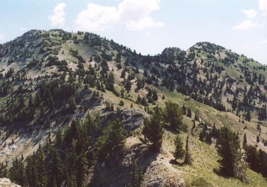
From the Solitude area, the Honeycomb Cliffs are a prominent and rugged set of peaks. However, from Twin Lakes Pass, they are easily climbed up a slope that is nothing more than a steep, off-trail climb.
Twin Lakes Pass can be reached from either Brighton via a short hike of about 2.5 miles gaining 1,200 feet. An even shorter approach is from Little Cottonwood Canyon and Grizzly Gulch. This route is about two miles, but climbs a little over 1,300 feet, so it is steeper. In 1995 I climbed this peak via Grizzly Gulch and Twin Lakes Pass. Along the trail you'll have fine views back down the canyon and of rugged Mount Superior.
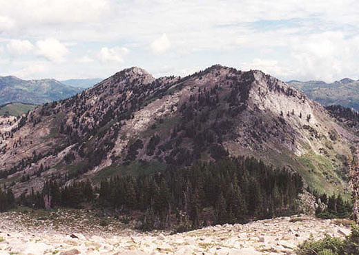
From the pass at 9,993 feet, it is a short climb of 500 feet up the hillside to the north. It is light forest and gravel all the way, and you won't reach a cliff until you're on the first peak. The first peak shows on the maps as 10,479 feet, but the topo maps show the second peak to be slightly higher. A short, but more rugged (not severe) trip leads to this second peak.
Evidently in 1995 I didn't take many summit photos because I couldn't find any, so much like nearby Mount Millicent I'll be returning to climb a combination of these Brighton peaks to get more summit photos in summer of 2001. Roundtrip distance for Honeycomb Cliffs is five miles and a climb of about 1,850 feet. Expect the climb to take about three hours.
The hike up Grizzly Gulch is a pleasant old mining road, and passes the ruins of several mines along the way. It is just over two miles and about 1,300 feet to Twin Lakes Pass. From the pass I was able to follow a steep, but pretty decent track up 500 feet right to the top of the first Honeycomb Cliff, at 10,479 feet. However, closer inspection of the topo map shows the second peak to be slightly higher. While initially the traverse looks a little hairy, a faint track was followable right to the higher peak. However, the better views are had from the first peak. Going at a modest pace I made it up both summits and back to the car in about three and a half hours.
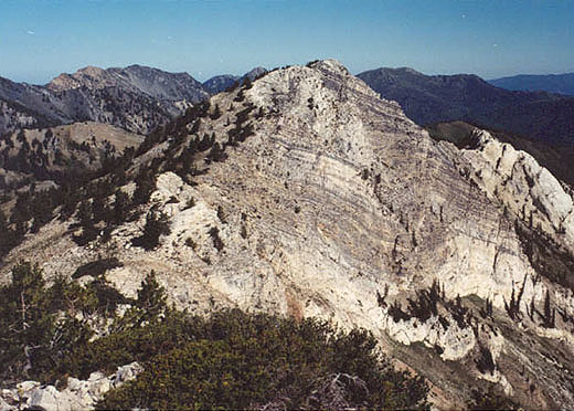
2004 Update: Looking for another route up Honeycomb Cliffs, I took the Grizzly Gulch trail to a ridge between Honeycomb Cliffs and Davenport Hill. About 1.5 miles up the Grizzly Gulch trail, the route splits with the main trail (old mining road) leading to Twin Lakes Pass, and the left junction heading to the ridge. This split is just a short ways after a steep, rocky section of the trail. This branch is very enjoyable, with great views back down the canyon. Just before reaching the ridge, a trail goes left towards Davenport Hill. This is a good spot to leave the trail and start route-finding up the steep slopes of Honeycomb Cliffs. Contrary to the name, there are no cliffs to work around. This takes you directly to the higher, northwest peak. Rather than cross the class 2 ridge again, I headed down, and instead opted to climb Davenport Hill, which was a five minute walk along a trail.